Geography
How large is Granada?
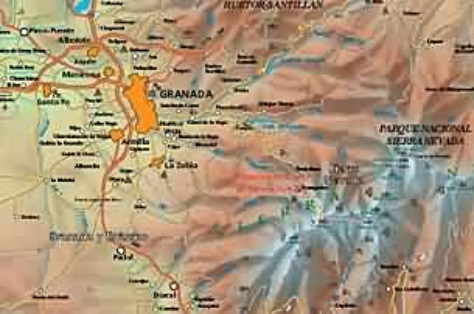
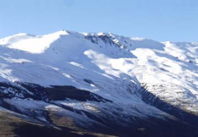
Granada has an extension of 12,531 sq. km (4838 sq. mi) and its altitude range from the 3480 m (11,417 feet) of the Mulhacén peak (Sierra Nevada mountain range) to the 0 m of its coast. The territory geography is shaped by incredible contrasts: the high peaks of Sierra Nevada, the Costa Tropical in the south, the inaccessible mountain valleys of the Alpujarra, the moon-like scenes of the Hoya de Guadix, the vast forests of Huétor Santillán, the “secanales” of Huéscar, etc.
What type of land is it?
Granada, Spain is located at the point where the Sierra Nevada mountains meet at the fertile plain of the Vega. Behind the point where those places meet there are steep mountains, and in front there is flat agricultural lands.
What bodies of water is around Granada?
The Mediterranean Sea
The city of Granada is traversed by several rivers, the most important ones are Genil (main tributary of the Guadalquivir river) and Darro, the flows into the Genil in the very city Center.
What surrounds the country?
Between altitudes of 650 and 800 m (2132 – 2624 feet), Granada dominates its Vega ruled by the Sierra Nevada Mountains. This privileged location determines the wonderful panoramic views this city offers. The ancient city also conserves the urban environment with picturesque sites dominated by the Alhambra.
Where is located on the globe?
Granada is located in Europe on the globe. The capital city of Granada is located 37º 10’ 18” north latitude and 3º 35’ 56” west longitude (Greenwich meridian) and 683 m (2241 feet) over sea level. This geographical layout turns the city into a continental land with climate features more similar to the Castilian plateau than to the Mediterranean countries as Sierra Nevada mountain range creates a barrier that do not let the sea breeze flow.
Climate
Average temperature: 15.3ºC (59ºF)
Its climate is basically continental and despite the average annual temperature is 14.8ºC (58.65ºF),
Winter average: 7ºC (19.80ºF)
January has an average temperature of 6ºC (42.8ºF) but with maximum levels of 20ºC (68ºF), whilst in with highest levels of 40ºC (104ºF).
Summer average:27ºC (80.60ºF)
Granada first inhabited and grew, because it was easy to defend themselves from their invaders from behind, and although it is dry in the summer there is always a supply of water coming from the mountain, by melting snow, the rich soil in the Vega provided a surplus in the food.
Autumn average: 25ºC (77ºF)
Annual rainfall: 402 mm.
Rainfalls in Granada are scarce with an annual level of 474 liters and mainly between October and May. During the summer it almost does not rain.
There is a great contrast between the long summer and winter seasons and the short spring and autumn seasons.

